Riding into the Mountains...
Christian Churches in Vietnam are large, clean, and...

...well maintained.

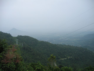
Today's ride would take me up into the mountains. Over 6%-10% grades, I would climb at least 5,000 feet in approximately 25 miles. Once the climb began, it would be uphill all the way with only very short breaks of either flat ground or slight downhills.
At the beginning of the ride, I backtracked to the North to an intersection where a sign was located that indicated "Da Lat." The hotel manager told me that this was the route I should take. I crossed Highway 1A in one kilometer and continued to the west. I was looking for Highway 20. It was not clear that I was on the right highway because none of the mile makers (actually kilometer markers) showed the name of my destination: "Da Lat." The towns that were indicated were Hiep Thanh, Thanh My, and D' Ran. The first two towns were off of my route, but D' Ran was on my route, so I was reassured that I was on the correct route.
I was looking for Highway 20, but the mile markers said Highway 27. When two highways share the same route in Vietnam, the mile markers are not always clear. Sometimes, this is even true in the U.S. From the map, I knew that I was in the right place. The map indicated that I was on Highway 20, yet the mile markers indicated that I was on Highway 27. I was somewhat worried, but I seemed to be going in the right direction.
I was futher confused though when I noticed that Tan S'on was shown on the mile markers as being ahead 27 kilometers. That seemed strange to me because my map indicated that I had passed through Tan S'on some five kilometers ago.
Climbing to Da Lat


In Nha Trang, two days prior, I had gathered some intelligence about the road to Da Lat. There was a new road, Provincial Route 723, that comes straight from Nha Trang to Da Lat, but I was told that it was partially finished and the location where it was not finished had become a wide river because of the heavy rains that had fallen over the last few days. PR 723 supposedly has a good surface and wide shoulders and had been widely praised as having nice views. Highway 20/27, however, had been described to me as the old road. By old, it was meant that the road was rough, narrow, and curvy. This made for hazardous riding conditions, but fortunately there was very little traffic that used the road. Except for one or two close encounters with large buses, the road was pleasant and safe.
Curvy Roads and Waterfalls.

At the beginning of the climb, I noticed two pipes from the hydroelectric system that climbed up a steep mountain and connected to a reservoir that sat just above D' Ran.

I began my climb, the road switched back and forth crossing under the hydroelectric pipes a couple of times. People using the road or working along the side were shocked to see me climbing the road. Some cheered me on as I climbed. Others laughed.


Once I reached D' Ran, I had planned to grab a bite to eat. But the roads in D' Ran were muddy and there was no place to stop. So, I grabbed some water and continued going. The road to Da Lat was located at a right turn near a communist monument. I could have turned left and followed a more established road, but that would have added 20 miles to the ride. Now following the road to the right, the road narrowed significantly and I thought that there was no way that a bus would go up this road. One hour later, I would be proven wrong as a bus would pass me by almost pushing me off the road into the drainage ditch.
The road to Da Lat climbs almost the entire way. Leaving D' Ran, I was not given a break. The road continued at a 6 to 10 percent grade. Exhausted, crabby, hungry, and thirsty, I stopped by a coffee field that had a view of the reservoir above D' Ran.
After lunch, still exhausted, I decided to push my bike instead of riding it. I eventually got on the bike, but I again pushed the bike later on as I came into a village. I was exhausted and my legs were so tired, it was hard to turn the pedals over. The road became flat after the village and I was able to ride most of the way for the next 15 miles into Da Lat.
In last few miles into Da Lat, I noticed a lot of orange fruit hanging from the trees. But, I could tell that these weren't citrus fruit. No, the trees were full of persimmons. When I arrived in Da Lat, there were people selling this fruit in every stall.
I entered Da Lat and rode towards the tourist section of town. As I entered that area, A woman came out to direct me to the Hoa Binh or the Peace Hotel I located at 64 truong Cong Dinh street. There I met the an Easy Rider, Stephen, who speaks English, and who offered me a tour of the area by motorbike.
Day 60 - Phan Rang to Da Lat - 100 Kilometers

No comments:
Post a Comment