Friday, September 7, 2007

Day 41 - Sabbattus, ME to Nobleboro, ME (September 6)

Time to be traveling along...


It was now time to get back on the road. I asked my friend Melodie to get me closer to my destination. We drove to Sabbattus, Maine where I headed east and Melodie headed back to Manchester, NH. I was sad to part. Even though I like to have my time to myself, I had been with people for the past week and I had grown used to having a lot of people around. But, I was now getting back on my bike and would now, mostly be solely with myself, for the month.


Here's a rare photo. A photo of my behind. Oops, I mean, a photo taken from behind. Fortunately, the driver of this vehicle was friendly to cyclists in general, and to me in particular.


The ride was obnoxious. Maine is NOT a good state for riding. There are no shoulders. The roadways are deteriorating and many roads have heavy traffic. Additionally, there is no flat. Every road climbs for a while, descends for a while, etc. I continued with this up and down rhythm to Damariscotta where I ordered a burrito, got some food and continued.


On the ride the wind blew strongly from the southwest - the direction of the ocean. After fighting these winds for many hours, it finally occurred to me that these were afternoon sea breezes like those that occurred in San Francisco. The only difference being that the breezes blew from the southwest instead of from the Northwest. It’s nice to be back at the Ocean.


My destination was Lake Pemaquid south of Nobleboro. My friend’s parents have a house on the lake and I spend the next few days here to work on my law school applications. Think “On Golden Pond.” It‘s a nice shallow lake surrounded by trees.


Day 41 - Sabbattus to Nobleboro - 48 Miles

Two Days of Hiking in the White Mountains (September 4/5)

On the first day, we drove by the Mary Baker Eddy house in Rumney and then went up the nearby falls. Our real destination was Franchonia Notch where everything has a price even the $20 per person entrance fee to visit the Flume. Boy, New Hampshire is a different place!


In 2003, the Old Man in the Mountain came tumbling down. So obviously we didn't see this. Disgusted by the price, not able to see the old man, and hoping to get a more authentic hiking experience, we hiked up to Indian Head. It was a nice hike and we had the trail to ourselves after almost being run over by some folks coming down the trail. I guess no one ever told these people to yield to the uphill hikers. Oh well, what (the hell) can you do?


Spent the night in the Woodstock Inn, which I highly recommended to anyone who will be traveling in this area. Very homey/bed and breakfast like. And it includes breakfast. The highlight, of course was watching the locals sing, poorly, before the Karaoke machine and their loved ones.


Dancing at the Summit while the West burns...


The next day, retraced the route I followed last year when I went to Swing Out New Hampshire - over the Kancamagus Highway, through the Albany covered bridge, and onto Conway ( a cheesy tourist town, if there ever was one). Stopping at Sabbaday Falls, we took in the sights.


Sabbaday Falls


Albany Covered Bridge


We then went to Mt. Washington, the tallest mountain on the east coast, where we drove to the top. A private company owns the road to the top. The ride was on a steeply graded road where no bikes are allowed (though a local claims that the road can be ridden early if a friend meets you on top with a car).


Some trees have just begun to turn.


Mt. Washington Cog Railway. $60 per person gets you to the top. A real smoker!


View from the top. Can you see the road? It seems to drop off of the edge in the background.


Day 40 - SONH to Rumney, NH (September 3)

SONH: Swingout New Hampshire.


After dancing until 4:15 a.m., I decided to get up eat breakfast, and watch friends load up on the bus to return to Boston and New York.


I had left my food bag in my friend’s car. Matt had danced all night and he was going to rest until 11 a.m. So I took the time to tighten up some bolts on my bike and do some other minor repairs.


Finally getting on the road, I headed to Hebron and towards Rumney. I looked at a map. A map is flat representation of reality. The shorter route went up through Groton and to Rumney. The longer route went to the other side of Newfound Lake and up to Rumney. Reality doesn't always reflect the lack of contours on a flat maps. The ride was hilly! Coming after two nights of little sleep and days of dancing, I was exhausted.


Resting after a long ride...


Along the way, I stopped to visit the house of Mary Baker Eddy. This is the house she lived in after her homeopathic, faith-based healing conversion. The next day, I visited the house she lived in before her conversion and founding of Christian Science (the house is in Rumney). An author showed me around the house. He was a former Middle East and Europe editor for the Christian Science Monitor. He was writing a book and he had escaped to New Hampshire for some quiet.


Leaving the house, it was a dramatic descent into Rumney. There is a stream next to the Mary Baker Eddy house. This steam makes the same dramatic drop. Apparently, in the springtime, kayakers make the same drop in their boats. Of course, in September, there is almost not enought water to catch a fish.


Arriving in Rumney, I met my friend Melodie and her friend Paul who has a house right under Rattlesnake Mountain, a popular climbing spot. Paul runs a website for long-distance hikers. Being a long-distance cyclists, I was very interested to hear about his travels.


Paul has a real farm, ducks and all...


Melodie and I went on a hike to the top of the climbing ridge. Half way to the top, we stopped. When hiking or walking around the woods, there always sounds - the sound of a bird, rustling caused by a bird, chipmunk, or snake. While waiting there, we heard a different sound. This was the sound of a breaking branch that could only be made by something as large as a human. I saw something black moving towards us and in front of us. I didn't think we were in grazing lands. Even though we were in a state park, I didn't see a fence when we began our hike which would have indicated that grazing occured on this land. The shape I saw was black. It couldn't be a cow, but it was approximately the right size. Melodie and I stopped talking. I pointed out that it must be a bear. Then realizing that the bear didn't hear us when we were talking and that the bear might come right to where we were, I stopped up and yelled. The bear turned and ran off into the woods.


For me, this was exciting. All the hikes that I had done so far were by myself. Also these hikes were done in bear country. I never once saw a bear. So to finally see a bear in the wild was nice. To see a bear when I had a hiking partner was even nicer - it made it less likely that we would be attacked.


Day 40 - SwingoutNH to Rumney - 18 Miles

Swingout New Hampshire 2007 (Aug 29 - Sept 3)

And they danced...

Four and a half days of dancing. Two nights of all night dancing. A real landing spot for east coast swing dance enthusiasts. So why was I there? I had been to other swing camps in the past, e.g. Swingout Catalina, but this swing camp had the best of two worlds - it did a good job of recreating a camp like feeling (down to the pink bug juice and mediocre food) and it had excellent instructors, good dance bands, and friendly dancers.


I approached this camp with excitement and a small bit of dread. I hadn’t been doing much dancing over the last year. Too much surfing, I guess (actually, LSAT prep). Even though I had been there last year, I still didn’t know many people. Additionally, I knew I would go through a variety of emotions during the day. It was the Lindy Hop Camp emotional rollercoaster. In each class, they would teach us a new routine. In the beginning of each routine, I would feel confident, but as the routine progressed, I would nor feel as confident. If a follower commented on my good lead, I would be happy. Often times, a follower would leave with a scowl on their face. Almost always, this meant that the follower was not happy with their own technique. But at the end of a class, getting 10 scowls, one begins to feel pretty low. Also, a follower would offer advice or direction. In most cases, this advice was well intentioned and appreciated. But sometimes, even though the advice was correct, I might feel hurt or burned by the suggestion. Such is the peaks and valleys of the Lindy Hop Camp emotional rollercoaster.

I was in Cabin 10 B - Boystown - Our Cabin was the only one to have a cyclist on its sign. The rest of the cabins had...I don't even remember. I think the cabin next to mine had a bully on its sign. What is that all about?


So we ate, danced, ate, danced, swam or played tennis, ate, danced, and slept, though not necessarily in that order. On the last night, we presented a routine that we had learned. I was in the group of dancers called the Chipmunks (Group 3A), just below the mean. Our practice dance can be seen here. I'm in the back corner somewhere.

Here's the routine that we actually performed. I'm barely visible in the far right hand side of the picture. Look for the male-pattern baldheaded cyclist - here.

Day 38/39 - Manchester, NH to Hebron, NH (August 28/29)

Ride Forrest Ride! - as heard by a group of teens on the ride to Hebron, New Hampshire.


Yawn. The night before I had met up with my first coach with Team in Training. We caught up and had a beer. Beer. I’ve drank more this trip than in the past 10 years. So it only takes one or two to put me to sleep. Anyway, coach Tim and I caught up on the goings on in New Hamster. It’s not the San Francisco Bay Area, but at least housing is affordable, for now.


The bike touring mantra is this: getting out of your starting town can take forever. Day 38 was no exception I had such a large to do list: buy some bowling shoes for dancing, buy some clothes for dancing, stop by the local bike shoppe (of course the conversation turned to politics...), get hardware to fix the new bike rack that I purchased, and mail extra stuff back home.


I finally began riding at 4 p.m. I had only ridden 10 miles at this point. So I finished in the dark - 2 hours of riding in pitch black. There was a full moon, but it didn’t do much shining through the dense woods. I had all the appropriate safety gear: highway construction-safety vest, reflective triangles on the back panniers, rear red strobe light, and front light. I put all of this on at once except for the front light.


I stopped to put on the front light, but I was not having any success. I had stopped at an intersection. It was getting dark and I just couldn’t get the light attached to my handlebars. A guy driving a Chevy drove right at me and then stopped. In the calm, I wondered what was going to come next? Was he going to shoot me? Maybe offer me a suggestion, like “next time ride on the sidewalk” (of course there are no sidewalks on a country road). Instead he just waited while I finally got the light attached. When he saw that I was done, he drives up to me and asks, “you doing alright here.” I said that I was fine and I thanked him for his help.


I continued into the dark. I would pull off into a driveway or onto the side of a road whenever a car would pass. Even though I had made my self as visible as possible, I didn’t assume that the drivers would see me. They barely see me during the daylight, why would their vision or awareness improve during the night?


I was always able to find a driveway to turn into when traffic passed. The east is different than the west. In the east, a “town” extends over a wide area. Inside each county is a number of smaller boundaries - townships. The township boundaries were shown on the roads that I was riding through - Bristol, Hebron, Rumney, Franklin. I would see the township boundary 3 to 5 miles before I entered the actual town square. In a township the houses, and thus the driveways are spread out. Spread out in such a way that it is convenient for a touring cyclist who is riding in the dark to safely pull out on when a car passes.


In the west, towns are separated by miles of empty open space. So the driveways come much less frequently. Most of the driveways I came across in the west lead to pasture land and would often be closed by a fence.


Stopping at the mini-mart where I almost gave up riding last year, I called my destination-"Lazy Acres Campground.” The campground wasn’t very helpful. I was only 10 miles away on a country highway, but the person on the other side of the phone didn’t seem to know where I was. When I finally got to my destination town - Franklin. I headed north towards the town center even though the campground address was 1000 something South Main Street. I did this because the campground manager told me that the campground was near downtown Franklin.


I rode through Franklin and kept going. I was now traveling north of Franklin which made it unlikely that I was on “South Main” anymore. After 15 minutes of riding, I turned around when I came into the next township, “Tilton.” I headed back to downtown Franklin to call the campground. The manager said that the campground was only 2 minutes south of the National Guard facility. I was a little hesitant to return to the National Guard because when I had passed the facility a few minutes ago, I heard a flurry of bullets. Apparently it was target practice time, I’m just glad they weren’t shooting at me.


Finally I arrived at the campground. It was dark, they had an entrance gate, they wanted too much money, they had no laundry, and a shower cost 25 cents for 3 minutes of shower. At the least I was off of the road and could sleep.


The next day was a short ride into Camp Wicosuta. Camp Wicosuta, a girls camp, is converted in to Swingout New Hampshire, at the end of the season after the girls have left.


Another difference between the west and the east - the hills. I ran into a former cycle racer from Belgium near the Grand Teton National Park. He complained about the hills in the east. Of course he was talking about the Appalachians, but this applies to the east in general. In the east, the hill slopes are 10 to 20 percent. “Just like the Alps”, said the former bike racer. The difference is that the Alps have grades that last for miles at a time. In the east, the climbs are very short. In the west, the climbs last for a long time and the grade is typically no more than 7 percent. So every climb is followed by a descent. Sometime a steep descent and then it is time to climb again. Up and down and up and down all day long. This up and down makes it hard to get into a good cycling rhythm - just when I have sat down and start to turn the pedals in a routine way, I have to stand on my pedals.


Along my way to camp, I passed different landmarks where Daniel Webster spent time. Mr. Dictionary used to live in the Franklin Area.


This is Daniel Webster. He looks a little angry.


This is the church at which Daniel Webster worshipped.


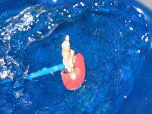
Before swinging into Camp Wicosuta and beginning my Swingout New Hampshire experience, I stopped at Wellington State Park on Newfound Lake. I watched the families enjoy the last days of summer as they swam in one of the clearest lakes in the region. The lake was clear as Lake Tahoe. It is spring-fed and this helps to ensure that is clear year round.


Yes, I have this dumb smile on my face as I ride. The remainder of the time, I have a raised fist and scowl as a car passes too close...


Day 38 - Manchester to Franklin - 63 Miles


Day 39 - Franklin to Wicosuta - 26 Miles