Thursday, July 12, 2007

Day 10/11 - West Glacier to Missoula (July 9/10)

Hammer time.

These two days blurred together. My goal was to get to Missoula as quick as possible to catch a flight. I actually arrived a day early which gave me a chance to rest and fix my bike.

The ride was rolling hills through national forest land. Nice country. I wouldn’t mind visiting again.

Swan Lake


Campsite at Swan Lake Store


On the first of the two days of riding, I stopped at Flathead Lake for lunch and discovered that one of my rear Ortlieb panniers had come apart. This was disturbing because I had just purchased them 3 weeks earlier. I fixed the pannier and went on my way. Finishing my ride on the first day, I camped behind the Swan Lake Trading Post and Campground.

On the second day, nothing much remarkable happened, except that ride was long and it was 90 degrees when I arrived in Missoula. The last 10 miles coming into Missoula were nice as I rode next to the famous Blackfoot River. I enjoyed watching the tubers rafting down the river. This reminded of me when I was young and used to tube down the Upper Truckee River near Lake Tahoe. Also, some of the female tubers were topless.

Old farmhouses before entering Missoula


I had one potential mishap riding into Missoula. On Highway 83 just before the Junction with Highway 200, the road was narrow. I passed a bike tourist with a poorly strapped-down load riding a mountain bike with a wobbly out-of-true back tire. Riding down a hill, a bunch of pickup trucks gathered behind me. They individually passed me as traffic started to drive up the hill from in the other direction. Because the road was narrow, this meant that the traffic in my direction would have to pass carefully. The last pickup truck started to pass. Just as it did, vehicles passed in the other direction on the other side of the road. This last pickup truck drove dangerously - it blew its horn and swerved towards me. I held the handlebars steady and wasn't bumped off of the road, but I my heart was pumping and I was irritated that this truck decided to pass me this way.

Day 10 - West Glacier to Swan Lake - 71 miles

Day 11 - Swan Lake to Missoula - 115 miles

Day 9 - Waterton National Peace Park to West Glacier (July 8)

A long day. Tour de Brad "Alpine" stage. A fantastic day of riding.

Before I got too far, I took these calm morning photos of the Upper Waterton Lake. It was very calm. So much so, that I was able to get these wonderful reflections off of the lake.

Anyone for an early morning swim?

I felt rested after my short ride yesterday. I only rode 37 miles on Day 8 compared with 70 to 80 mile rides for the last 5 days. Typically a rest day should involve no riding, but yesterday’s “rest day” ride was pleasant and easy.

The day was still cool with some lingering clouds. As I turned out off of the main road out of Waterton, I heard some rustling in the woods. I saw a brown bear turning into the forest. There was little time to respond though, I was busy beginning the climb of a steep hill and the bear was busy foraging for berries. We went out separate ways.

The next few miles were somewhat irritating. It was a climb followed by a descent followed by another steep climb, etc. Along the way, I passed a german cyclist who was navigating using his GPS. In a little while, I found myself at the U.S. border chatting with a border guard who is originally from Georgia, but is typically stationed in Los Angeles. Apparently the Chief Mountain border crossing is only staffed during certain hours of the day during the summer. Otherwise, during the winter and during the nights it is closed.

Welcome to the U.S.

Chief Mountain - The name of the border crossing

The road continued in it’s ascending/descending fashion for 15 more miles. Eventually, I reached Highway 89 which lead me to the little town of Babb. I was at the point where my cycling mood was low - I was tired and the traffic was zooming by caused irritation. Refreshing myself with a good meal at a local cafĂ©, I proceeded to St. Mary.

The original plan for today was to ride for 6 more miles and stop at the Rising Sun Campground. This would give me 3 days to get to Missoula, Montana by July 11.

After my rest day on Day 8, I was ready for a challenge. This was the first time, thought not the last, where I made an inial riding plan, and then scrapped those plans and rode further than planned. Changing my mind in the past, has lead me to keep riding into the dark or led me down a long road that leads through Indian Country. On a whim, I have ridden longer distances through great scenery.

Lake Saint Mary - and a small island.

That same island from a different angle

So I decided to just keep riding. I would try to get to West Glacier which would double the distance I had intended to ride. The goal was to summit Logan’s Pass riding through Glacier National Park on the Going to the Sun Road. There are restrictions for cyclists on this road. They cannot ride the western side of this road from 11 a.m. to 4 p.m. during the summer months. I was riding the eastern side of the road, so I would be “okay,” at least in terms of the regulations. But there was another consideration I didn’t think of: because I would be riding later in the day, there would be more traffic regardless of which side of the road I was riding. There wasn’t exactly a wide shoulder along this road.  For an overview of the ride, the GIS coordinator for the Montana Office of Tourism has created this useful guide.  Also, at the end of the ride, whether or not your ride ends in Missoula, it's a good idea to get a classic poster of the ride.

Sunrift Gorge

The ride though was amazing. Glacier National Park is stunning and Going to the Sun Road is a good way to get an excellent view of everything - the mountain peaks, the glaciers, the narrow valley, the tourists in their RVs, Harleys, and rental cars, not to mention the red and yellow National Park “Jammer” buses.

The climb though was a real challenge. Lucky for me, I was only riding the side that gained 2,000 feet in elevation. The western side gained 4,000 feet. This was quite a push as I had already ridden 50 miles at this point. The going was slow.  It took all I had to focuse on keeping the pedals turning over. Every now and then the effort was broken up by a stop to take in a sight or by a passing vehicle.

Jackson Glacier - less and less each year. Ironically, a nice place to drive your SUV.

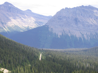
The small vertical slash in the middle of the forest was the road I just climbed.

The summit was eventually reached. There were many tourists at the top.

Going to the sun...

...and getting there.

I had to take a picture to prove it.

Now the best part began. Going down. The western descent was even more beautiful that the eastern ascent. I guess I could appreciate it more because I wasn’t focusing so hard on my climbing. The descent was so fast that I stayed at the speed of traffic for the next 12 miles. Actually, most time was spent applying the breaks. It was a steep descent. The smell of hot brakes lingered in the air. As I began to get worried that my breaks would wear out, I reached the bottom of the descent.

After the descent, I had a huge dinner at Jammers near Lake MacDonald. Pizza, break sticks, salad, and brownies with huckleberry ice cream. Good stuff.

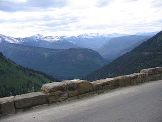
The little line across the picture is the Going to the Sun Road.

At this point, I didn’t have any camping reservations. But I wasn’t worried as it was a Sunday evening and I reasoned that there would be some vacancies. However, the sun was setting and I kept passing campgrounds that had “no vacancy” or “full” signs. Arriving in West Glacier, I couldn’t find a vacant hotel room. I was getting desperate. Finally I saw the sign to a campground. This looked interesting - 175 sites. There should be at least one site that I could use.

In fact, this campground, Glacier Campground, had plenty of room for a bike tourist and I was charged the very reasonable price of $6 plus tax for the site. This was in contrast to the other campsites that I had passed that wanted to charge from $17 (for a no frills campground) to $35 (for a campground with laundry, shower, and Internet access). I was very excited that I had stumbled on a great campsite. One problem though. The campsite had a restaurant with wonderful food made from scratch. But I had eaten already and I would be up too early to enjoy the food the next morning. Well at least I was able to take a shower and do my laundry.

Another touring cyclist was staying at the campground. She had just finished nursing school and had ridden from Moab, Utah.


Day 8 - Pincher Creek to Waterton National Peace Park (July 7)

A rest day

Today was a good day. The east wind yesterday that had caused me so much grief had brought in clouds. To me it almost looked like fog - the clouds were really low. It was probably 60 - 70 degrees Fahrenheit. The wind was generally at my back. It was overcast and a few rain drops fell (no more than 10 drops). I stopped and chatted with a couple who were on a guided tour. They were from Oakland. They took a photo of my fully loaded bike.

Scenery Along the Way to Waterton


Arriving in Waterton at around 10 a.m., I stayed at the Waterton Township Campsite - near the water and far away from the RVs, but surrounded by prairie dog mounds. Lots of chirping.

When I arrived there were only 2 “walk-in” tent sites. It was a nice site right next to the prairie dogs. It was so cloudy that the top of the peaks were not visible. The clouds were so low that they obscured at least two-thirds of the mountain.

My Prairie Dog Neighbors


I met Jim at my campsite. He too was a minister (Pastor) from the United Church of Canada. He was from Winnipeg, Manitoba. He was doing a small ride around the area while his three girls and his wife were at the Calgary Stampede. He said that he knew of the minister I met in Pincher Creek.

I ate at Subway to get out of the cold and ran into Jim again. I took a nice 2 hour nap while listening to a local station that was playing Jazz. The weather was still cool. Something was also different - there was no wind. The Waterton Lakes lie in the narrow gap between two mountain ranges. Typically, the wind whips through these mountains. This causes the lake to have whitecaps. It is rare that the lake surface is smooth. During my visit, however, the lake was very calm and in the mornings the lake surface was glassy smooth.


Later on I walked over to the beach where I surprised Jim who was sleeping - he thought I was a bear. This is understandable. Early on Jim had decided to climb a mountain called the “Bear Hump.“ It’s supposed to be shaped like the back of a bear. The trail was busy, but not busy or noisy enough to cause bears to stay away. Jim hiked by himself.  At times, he was all by himself. So when finally came across a grizzly bear, he decided that it was best just to back down the trail slowly.


So when I told Jim I was going to hike to Bertha Falls, he was more than willing to join me. It was a nice hike. Stopped at the overlook where I left my jacket. Jim and I walked up to the Falls and down again, but I had to return to overlook by myself . A black bear had been spotted in the area. Previously that morning, I had spoken with an outgoing gentleman from Durango, Colorado who had told me “horror” stories of how this bear had become a menace to the town. So I was somewhat worried as I rushed back to the overlook to get my jacket. I ran into a number of people along the way, but none had seen the jacket. When I arrived, the jacket was still there. I made back to the campsite without encountering any bear whatsoever.

This was not the first time I would leave my jacket somewhere. I also left my jacket in Quang Ngai in Vietnam. It was much harder to get the jacket back in Vietnam, but I didn't have to risk stumbling across a grizzly bear to get it.


I met two recumbent bike tourists from Vermont who made part of their living cycling and writing. They had written about cycling in Canada and in Cuba.

Day 7 - Fernie/Hosmer to Pincher Creek (July 6)

Riding into the Prairie

This is what my bike looks like when it is loaded and ready to go.


There are bear-proof garbage containers all along the way on highways in the Canadian Rockies.


Today I ended in a little town called Pincher Creek. I crossed the continental divide, leaving Britsh Columbia and riding back into Alberta, Canada. The continental divide crossing occured at Crowsnest Pass. Crowsnest is the name of the mountain pass as well as a set of towns all located in a coal mining valley. Shortly after passing through Crowsnest Pass, mountains receded and I entered the prairie. This was a nice change of scenery because I was no longer "trapped" in the mountains and I had clear view for miles and miles.


My general disposition? These days, it depends on the outside temperature, the direction of the wind, whether there is a shoulder with a rumble strip (or not), and whether cars give me a wide berth. Today was harder because the temperatures reached above 100 degrees and I had a head wind. Typically the wind blows from the west, which would have been at my back. But today, it was from the East. A wind from the east in this part of the country sometimes indicates a storm front. Today, the approaching storm front didn’t benefit me - it only resulted in tiredness, but tomorrow, it would be a benefit.


Before climbing out over Crowsnest Pass, I stopped in the town of Sparwood. There is a lot of coal mining in this area and a very large coal hauling truck was on display right next to the highway.


I stopped at a Subway sandwich in Coleman. There were a lot of people in the Subway even though it was only 10:45. Parents and their soccer playing children lined up for food. I started a conversation with a woman in front of me. She and her husband had toured by bike in the past. So we talked about touring and the surrounding area. They lived in my destination town and they were in Coleman because every year, the towns in this area of Alberta get together and hold the summer games - games for all ages from young soccer players to older cyclists and runners. This year, it was held in Coleman. As I was leaving Subway, I said goodbye to the family. The family then invited me to stay with them in Pincher Creek. I was surprised and glad for the invitation. It would be nice to get out of the heat and eat a real meal with human company.

The family would be in Crowsnest Pass for a little while longer, so I continued on. My next stop was the town of Frank. This old coal mining town had a tragic accident on April 29, 1903. Because of the geological uplift in this area, a coal seem lies close to the surface near the base of Turtle Mountain. The mountain is not very stable because of the material of which it is made. So early on the morning in April 1903, a huge amount of the mountain came tumbling down and wiped out 10% of the town’s residents. The rock slide came all the way down the mountain, “jumped” the river, and traveled many at least one half of a mile up the other side of the river.

The slide has a nice interpretative center. So after eating my sandwich in the hot outside temperature, I entered the air conditioned interpretative center to watch the 45 minute docu-drama about the slide. It was very informative. Take home message: don’t place your town below a geologically unstable mountain and don’t mine the coal seam beneath it - it may cause the mountain to fall!


After leaving Frank, I continued onto Pincher Creek. Headwinds from the east were my constant companion. Arriving early in Pincher Creek, I stopped at the local library which had free wireless access.

Eventually I rode to the family’s house. These were the folks I met in Coleman at the Subway sandwich. The father was a minister in the United Church of Canada. I had a nice dinner, a nice visit to the church, and nice chat with the family. It was really nice to get to sleep indoor and out of the heat.

Mining.

This area around Fernie, Sparwood, and Crowsnest pass has a lot of coal mining activity. The coal mining activity affects the watershed, the health of the miners, and groundwater. BP currently wants to reopen a mine upstream of the Flathead River near Fernie, BC. They don't want the coal.  Instead, they are seeking the natural gas.

Picture of a strip mine on the continental divide near Crowsnest Pass.


Day 7 - Fernie/Hosmer to Pincher Creek (July 6) - 74 Miles

Day 6 - Wasa Lake to Fernie (July 5)

The day started early. I got started at 6:00 a.m. so I could beat the heat.

I snapped a picture of Mt. Bill Nye before I getting started.


Stopped briefly at Fort Steele.


The ride along Wardner - Fort Steele Road was fantastic. The sun hadn’t yet risen above the mountains called the “Steeples.” As I passed the provincial park, I saw some Elk grazing. I also heard a coyote howling in the distance. The road was peaceful and calm and otherwise free of cars. The fact that it was in the dark was even better - the temperatures were still cool.


So I rode on to Fernie, BC. The ride into Elko was challenging - it was a big climb. The warmth of the day was just starting. I checked with a local shopkeeper about an alternative route on the other side of the river. My choices were either a paved highway with lots of traffic or a backcountry dirt road. After consulting with the shopkeeper, I found that the back road had too many ruts and potholes and also logging trucks as well. So I decided to stay on the main highway. The ride wasn’t too bad. Even though the shopkeeper insisted that the local drivers were really good, I think she has never ridden a bike between Elko and Fernie. The ride along the Elk River was nice.


I stopped and rested a while in Fernie. I did my grocery shopping and talked up the locals to figure out where I could get a good lunch. A guy behind me in line suggested a bakery called Sinful Sweetness. This was a nice place to rest, watch, talk, and write.

It was cool inside Sinful Sweetness, while the temperatures outside rose into the mid-90s. I had a nice lunch and had a chance to write in my notebook. The bakery had a large window - I could watch the Fernie people go by and I could also watch my bike which was parked outside.

I noticed a couple outside inspecting my bike. They came into the bakery. She, Shana, was from Portland, Oregon. He, Stephan, was from Whitefish, Montana. They were also bike touring. They had just started. This was her first bike tour, but he had toured in the past. We had a great discussion about riding with others, cycling moods, drivers, and the benefits of free campgrounds. They would be following the route I had just done, except they would be going in the other direction. They had a general map of the area, but not a specific map. I gave them my Adventure Cycling map. I hope it helped them.

I actually spent the night down the road at a place called Hosmer located under Hosmer Mountain.


Domesticity

While talking with Stephan and Shana at Sinful Sweetness, we discussed the routine that one falls into when riding. I hesitate to call this a vacation. It is travel, but not a vacation. A vacation implies freedom from work and the normality of ordinary life. Bike touring has an ordinariness to it, obviously. I ride my bike every day. But there are also the daily household tasks that I do. For example, I have to make breakfast in the morning, pack my stuff, and take down my tent. I do this almost every day. I normally eat lunch at a store or restaurant, so I don't have to worry about this. I have to buy food to eat for my meals on a regular basis - every 2 to 3 days. At night, I have to set up the tent, get the stove working and cook some food. I'm not cooking anything gourmet, but it still takes time. If I'm in bear country, I have to put everything away - anything that smells. If I'm not in bear country I leave out my stove and use it in the morning. This routine provides a modicum of stability in an ever changin landscape.

Day 6 - Wasa Lake to Fernie - 74 Miles