Ugh...
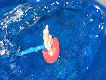
Before I get into the challenges of today's riding. I stopped to look at a small natural bridge near my campsite. Bridge Bay is named for the natural bridge that is located just south.
My bike stands in as my surrogate in my pictures.

Naturally, A Bridge

The roadway was bad, bad, bad today. And the drivers were bad, bad, bad today. The roadway from the West Thumb Junction in Yellowstone south to the entrance of Grand Teton National Park is dedicated to John D. Rockfeller. He should get off of his rump and repave the road with wide shoulders. And straighten the road while he is at it. What's that you say? He's not alive?
This is a picture of West Thumb. Yellowstone Lake is shaped like a hand, a right hand to be specific. West Thumb is located on the west side of the lake. That narrow opening leads to the rest of the "hand" that is Yellowstone Lake.

The road was narrow and had no shoulders. It was also curvy. This made it hard for cars to pass. So very often cars would pass closeby. Obviously, I didn't like this. Fortunately, most cars slowed down while passing.
At least the view was nice. There were three scenic points: the West Thumb Geyser Basin, the Lewis River from Lewis Lake to the Southern YNP boundary, and Jackson Lake.
I stopped at the West Thumb Geyser Basin to do my business and see some more geysers. I had considered just continuing on, but I decided to look at more geysers. I mean don't all the geysers look alike? Not these geysers.
My friends and fellow touring cyclists, Luis and Marta (from Madrid, Spain) were also stopping here for a mid-morning snack. Marta was of the opinion that all geysers were alike. So they were only stopping for a snack. I joined them for a snack and then looked at the Geysers.
I'm glad I did. In fact, I wanted to linger a while. This is hard to do when touring. When touring, I stop and look at things for only a short while, but I have to keep moving because I have to get to my destination.
This geyser basin made me want to stay for a while. Yes, it had all of the typical geyser features - geysers, mud paint pots, vents, steam, rotten egg smell. But it had something more. It was right on the enclosed West Thumb bay of Yellowstone Lake. Yellowstone Lake has water clarity like Lake Tahoe did 30 years ago. The water was a wonderful blue color, there was a nice sandy cobblestone bottom. I wanted to go for a swim or sit on the beach for a while. Of course because of the geysers and the heat and the acid and the sulfur, the beach was closed.
So I enjoyed the lake and returned to the picnic area to pick up my bike. When I did I noticed two other bikes - those of Luis and Marta, but the riders were not there. Where could they have gone? To the geysers I guessed?
Too bad, I wanted to say goodbye. Because Marta and Luis were only going to ride for 40 miles today, I wouldn't see them anymore.
Later I arrived at my campground. I went about my business setting up the tent, organizing, etc., doing the domestic part of the ride. As I was heading out, Luis and Marta arrived. They decided to ride on to a campground with a shower. So it was nice to have company during the afternoon and for dinner - to discuss history, politics, and tell them about California (they were planning on driving to California to ride the Coast in to San Francisco).
Day 27 - Bridge Bay to Colter Bay - 67 Miles

2 comments:
Hey, it's not the entire roadway from West Thumb to Grand Teton that's the Rockefeller Parkway, just the bit from the South Entrance to Grand Teton. That part definitely has shoulders; it's the part in Yellowstone that's a pain to bike, though mostly downhill (much harder to go the opposite direction).
But, Rockefeller...LOL...don't get me started.
Cheers,
Jim
Dearest Jim,
I have to disagree. I thought the entire road from West Thumb sucked. Yes, it was scenic, but there was no shoulder. The drivers sucked (as usual) and the curvy roads made it hard for cars to pass safely. Other than that it was another beautiful day in the pak.
Post a Comment