Showing posts with label Montana. Show all posts

Sunday, July 29, 2007

Day 23 - Cooke City, MT to Red Lodge, MT (July 29)

Welcome to the Beartooth Highway...

This was a very challenging day. This was the first mountain pass that I have climbed on my bike that was over 10,000 feet. My lungs hurt, my legs hurt...actually that was it. Just my legs and lungs. After the climb, it was all the way downhill into Red Lodge (with a wind at my back). The ride was nice for a while - I had wide shoulders, but from 1/4 of the way to the top to 10 miles to Red Lodge I had no shoulder. This made for very irritating riding. I rode in the middle of the road to make sure that drivers didn't try to squeeze by me and run me off the road. Overall, the traffic wasn't that bad.

This is what it looks like to turn back as you drive east out of Cooke City.


Pilot Peak. A very unique peak visible for miles. See later photos.


Well it turns out that bikers do more than sit and rev their engines. They also play bagpipes. At least this guy did.


Climbing the Beartooth. Can you see Pilot Peak in the background?


This curvy road didn't seem so bad from the south summit, but let me tell you...


That little pointy peak in the middle? That's the Beartooth. Welcome to Montana.


In the descent into Red Lodge, these amazing glacial valleys are visible. Actually these valleys are only a 30 minute drive from Red Lodge.


The descent was steep and fast and wet. It had just rained and hailed.

Imagine the ride over Donner Pass from Sacramento to Truckee, CA. I have always found the descent from Donner Pass a little frightening. Now imagine instead of the slowly mostly strainght road that descends from Donner Pass to Truckee that there is another road. This road abrubtly turns right towards Donner Lake and then proceeds to switchback 5 times finally arriving in Donner Lake instead of Truckee. That is what the descent is like.


Day 23 - Cooke City to Red Lodge - 72 Miles - Dedicated to Pat Keegan

Saturday, July 28, 2007

Day 22 - Tower to Cooke City, MT (July 28)

Leaving the Park...


This guy wandered through the campsite just as I was packing my bags. I heard a noise and looked up and here was this Bison. Good thing it wasn't a bear.


Here's the first Bison's buddy.


Overhanging cliffs near Tower Falls.


Down at the bottom of the slope near the river is Calcite Springs.


Lamar Valley in the morning. There are a couple packs of wolves and a grizzly bear out there somewhere. Can you see them?


Soda Butte Geyser.


10,000 foot peak near the Northeast Entrance to Yellowstone National Park.


Day 22 - Tower Falls, YNP, WY to Cooke City, MT - 36 Miles

Monday, July 23, 2007

Day 18 - (July 24) West Yellowstone to Madison Junction, Yellowstone NP

Nice day for a ride.

I began my ride early. After some administrative things - email, etc. it was time to ride into the Park. I was concerned that I would not get a campsite, so I left early. What I found out is that I didn't have to worry. Luckily for me, there are hiker/bicyclist spaces at almost each campsite in Yellowstone National Park. Except for the popular campgrounds (Madison, Lewis Lake, Colter Bay - actually in Grand Teton), a hiker/bicyclist space is always open. In fact, if one were in good cycling shape, one could bicycle tour all of Yellowstone NP in the summer and not have to make a reservation. Read on, because that's just what I did.

What's this? I can't ride on the boardwalk? But I can ride singletrack (see below)!


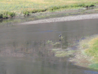
A Blue Heron in the Middle of the Madison


The original plan was to take two rest days in Grant Village. But the guidebook that I had didn't think that Grant Village was that nice. So, I didn't actually "rest", I changed my route and went to Norris Junction and Canyon instead (see the next two days).

Here's Old Faithful. Right on time (or not).


This Rarely Erupting Geyser (not Old Faithful) really let loose. So much so, it soaked at least 30 people who were walking along on the boardwalk near the geyser.


Back to this day. There was alot to see. The ride to Old Faithful is nice. It is a mostly flat ride along the Firehole River. Yellowstone actually allows off-road riding, so I rode from Fountain Flat Drive to Grand Prismatic Spring.


Not Quite the Grand Prismatic, but Nice Anyway.


Geysers, Geysers, Everywhere.


Many Pools are Blue. Very Blue.


This Geyser Isn't So Active. Just Blue.


Some Have Bacteria Growing in Them.


Leading away from Old Faithful and leading to Upper Geyser Basin was this bicycle-allowed path. I didn't know that you could ride single track in the National Parks!


Day 18 - West Yellowstone to Old Faithful to Madison Junction - 53 Miles

Day 17 - Cameron, MT to West Yellowstone, MT (July 23)

Riding the Madison.


Today's ride was very tough. It started with an uphill ride into the wind. At mile 15, I passed a windmill vigourously turning in the wind. Not a good sign.


At least the scenery was nice. I rode along the Madison River. A Blue Ribon River for fishing. There were many ranches and lodges along the way that catered to fly fishermen. For example, this lodge, perched on the cliff above the Madison:


After 34 miles of flat, slightly uphill riding into the wind, I entered this river canyon (still the Madison River) that led to West Yellowstone.


Just as you enter this canyon, you see this 1959 slide that created another lake (Quake Lake) downstream of Hebgen Lake. This slide was similar in size and scope to the slide I had seen earlier in Alberta near the town of Frank. The Frank Slide was 74 million metric tonnes, while the Quake Lake slide was 80 million English tons (a metric ton is roughly equivalent to an English ton).


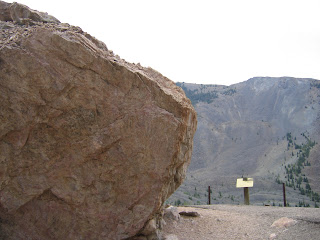
This is a picture of one of the boulders that slid all the way from top of the mountain across the river and up the adjacent hill.


Here is a picture of the other boulder (with the hillside slide in the background).


After marvelling at the forces of nature, I rode onto West Yellowstone stopping along the way at Campfire Lodge Resort for my second breakfast of the day. The restaurant is right next to the Madison River and the property is located under a grove of pine trees. A nice place to visit and stay.


As I neared West Yellowstone, I saw a big thundercloud in the distance. All of a sudden the head wind kicked up again and I had to ride with a stiff headwind for the next 4 miles. Finally, I turned 90 degrees to the storm, but I saw sheets of rain in the distance. I didn't mind the rain, but I was worried about the wind. Fortunately the riding wasn't as hard because I had turned perpendicular to the wind. But as I approached the sheets of rain, the wind turned into my face again which made the last 4 miles into West Yellowstone a rainy and windy experience. Of course, once I finally arrived in West Yellowstone, the rain and wind stopped.


Day 17 - Cameron to West Yellowstone - 64 Miles

Day 16 - Dillon, MT to Cameron, MT (July 22)

Just getting there. Scenic, but hot.

The first part the ride was flat along the Beaverhead River and I had the wind at my back.


Beaverhead Rock. Lewis and Clark stopped here with Sacajawea.


The city park in Twin Bridges is a nice place to stop.


Scavenging along the side of the roadway.

Today's ride provided a huge bonanza of stuff - 2 CDs and 2 DVDs. When I climbing slowly, my vision sometimes strays to the side of the road where I might see something shiny. Mostly its a bud light can, but sometimes it something useful like a CD or a movie DVD. No, I haven't found any dirty movie DVDs. So on this day, I found two music CDs - Dave Matthews and a Hip Hop CD. One DVD didn't work and the other DVD contained music. So far as for movies, I've found the Son of Monty Cristo (must be the sequel to the Count of Monty Cristo) and Alien vs. Predator. Later on, when I ride in Vietnam, scavenging isn't very fun. Because of the amount of garbage along the side of the road, I pass stray CDs every kilometer. Push your trash away folks!

Back to the trip.

Here's one of those crash-up derby cars from last night's derby in Dillon. This what the car looked like later on Sheridan, MT. It didn't fare so well.


This is the robber's roost located between Sheridan, MT and Alder, MT. In the mid 1800s, a group of men called The Innocents began robbing stage coaches and wagon trains that travelled between Bannack (the first regional capital) and Virigina City. The sheriff of Virginia City and Bannack, Henry Plummer, was the head of The Innocents. Eventually a group of angry citizens formed their own group, the Vigilantes. They caught, tried, and hanged the members of The Innocents ending the string of robberies.


The town of Laurin has an interesting Church.


They really wanted to find some Rubys and Garnett Stones along Alder Creek. So much so that all that is left is the cobblestone mine tailings.


Town of Virgina City. Almost a ghost town, but has be revived as a tourist stop.


Lunch stop. Real food - hummus plate! Yum!


It looks like you ride off a cliff here on your way to Ennis.


Between Ennis and Cameron, I met up with three cyclists crossing the country. They were near the end of their journey. We chatted for 20 minutes or so. They had a lot less gear than me. I guess they had gotten smart and realized that they didn't need half of the stuff that they had started with. I hope I realize this soon. I'm carrying a heavy load.

The Jail/Post Office in Cameron.


Surrounding peaks...


A meeting place for the surrounding farmers and ranchers. There is nothing but ranches around here. The nearest neighbor may be as far as 2 miles away. Sometimes neighbors share a common road, but they are still not located near to each other. So on Friday, Saturday, and Sunday nights only, the Cameron General Store serves dinner and serves as a meeting place for the people who live in the surrounding area. I think I was the only one in the restaurant who didn't know another person. Even the people from out of town seemed to know the others in the restaurant and bar. I guess the Cameron General Store serves an important role for the people who live in the area.


Day 16 - Dillon to Cameron - 85 Miles

Saturday, July 21, 2007

Day 15 - Wisdom, MT to Dillon, MT (July 21)

The Wisdom of our...

Apparently the owners of the Trading Post in Wisdom thought that Sacajawea was a little, how can I say this? Loose?

Here she is in a sexy pose above Conover's Trading Post.


This wasn't the only "strange" thing with Wisdom. Because they only camping option was a bare piece of ground managed by the American Legion, I decided to stay in a Hotel. $36 (plus tax) for the night (this, however, doesn't beat the most expensive hotel in Vietnam: $12). I really didn't sleep that well night. It may have something to do with these foxes that were caged up outside of the hotel.


Hey Foxy, Keep it Down, eh Buddy?


The sign for Hairpin Ranch signals the beginning of the day's first climb over Big Hole Pass.


Here's the climb. It almost looks like I was riding downhill, but I assure you it was up.


At the top, the Hamilton Ranch had posted these really nice information signs. This one claims that animal grazing is an effective BMP for stream bank stabilization. This may only be true for the stream bank shown in the photo.


I finally found my way to Dillon after running out of water 10 miles earlier. Fortunately, most of those miles were either downhill or flat. The crash-up derby was going on. Here's the parade of cars. See the next day's post to see how one of the cars fared (hint: not well).


These guys stayed up to 9 p.m. (it gets dark at 10 p.m.) colliding with each other. This was shortly followed by the Ozzy tribute band. That was not a problem because I was intending to sleep at 10 p.m. anyway and there's nothing that lulls me to sleep better than an Ozzy lullaby! Unluckily for me, my tent neighbors (2 couples, one foreign?) decided to play strip poker, spin the bottle or some other card game until 3 a.m. I was hoping to get up at 4 a.m.

Day 15 - Wisdom to Dillon - 69 Miles