Sunday, July 29, 2007

Day 23 - Cooke City, MT to Red Lodge, MT (July 29)

Welcome to the Beartooth Highway...

This was a very challenging day. This was the first mountain pass that I have climbed on my bike that was over 10,000 feet. My lungs hurt, my legs hurt...actually that was it. Just my legs and lungs. After the climb, it was all the way downhill into Red Lodge (with a wind at my back). The ride was nice for a while - I had wide shoulders, but from 1/4 of the way to the top to 10 miles to Red Lodge I had no shoulder. This made for very irritating riding. I rode in the middle of the road to make sure that drivers didn't try to squeeze by me and run me off the road. Overall, the traffic wasn't that bad.

This is what it looks like to turn back as you drive east out of Cooke City.


Pilot Peak. A very unique peak visible for miles. See later photos.


Well it turns out that bikers do more than sit and rev their engines. They also play bagpipes. At least this guy did.


Climbing the Beartooth. Can you see Pilot Peak in the background?


This curvy road didn't seem so bad from the south summit, but let me tell you...


That little pointy peak in the middle? That's the Beartooth. Welcome to Montana.


In the descent into Red Lodge, these amazing glacial valleys are visible. Actually these valleys are only a 30 minute drive from Red Lodge.


The descent was steep and fast and wet. It had just rained and hailed.

Imagine the ride over Donner Pass from Sacramento to Truckee, CA. I have always found the descent from Donner Pass a little frightening. Now imagine instead of the slowly mostly strainght road that descends from Donner Pass to Truckee that there is another road. This road abrubtly turns right towards Donner Lake and then proceeds to switchback 5 times finally arriving in Donner Lake instead of Truckee. That is what the descent is like.


Day 23 - Cooke City to Red Lodge - 72 Miles - Dedicated to Pat Keegan

Saturday, July 28, 2007

Day 22 - Tower to Cooke City, MT (July 28)

Leaving the Park...


This guy wandered through the campsite just as I was packing my bags. I heard a noise and looked up and here was this Bison. Good thing it wasn't a bear.


Here's the first Bison's buddy.


Overhanging cliffs near Tower Falls.


Down at the bottom of the slope near the river is Calcite Springs.


Lamar Valley in the morning. There are a couple packs of wolves and a grizzly bear out there somewhere. Can you see them?


Soda Butte Geyser.


10,000 foot peak near the Northeast Entrance to Yellowstone National Park.


Day 22 - Tower Falls, YNP, WY to Cooke City, MT - 36 Miles

Day 21 - Canyon to Tower (July 27)

It's raining outside, so I stay inside the cabin. This leads to a late start.

When I finally got going, I decided to take one last look at the Grand Canyon of the Yosemite before getting to my destination.

Upper Falls. They are not as tall as the Lower Falls.


But these falls are tall. Can you see the people on the other side of the river?


A parting shot of the Grand Canyon of Yellowstone.


After the Grand Canyon of the Yellowstone, I needed to climb 1,000 feet to get over Dunraven Pass, the highest pass that I had ridden over to date at 9,000 or so feet.

At Dunraven Pass, I decided to do a 6 mile roundtrip hike to the top of Mt. Washburn.


Nice views from Mt. Washburn. This is a section of the Grand Canyon of the Yellowstone downstream of the earlier photos.


There was an abundance of wildlife on the hike.


There is actually a small rabbit-like mammal in this photo called a Pika.


On the descent, it was getting late, so the wildlife (Bighorn Sheep) came out.


Traffic Jam.


Baby Bighorn


This one had crazy eyes.


Is this a grouse? A hen? A?


Say Cheese.


What a pretty bike.


Tonight's destination. Tower Falls.


The loneliness of travel.

Looking over the land from Mt. Washburn, I can't help but feel somewhat lonely. I look over the distances. In this wilderness, it takes a long time travel from point to point. In past, you would travel and travel and then get to a small town where your arrival signified something. Now the families zoom around from place to place. Stay in this place. Stay in that place. Find this campground. Find this hotel room. Does anyone connect with anyone else anymore? Maybe the bikers have it right. Get a big group of people together - go to a biker bar, socialize and meet other bikers. What if you don't like bars or aren't a biker? They out to have communal lunches and dinners at a given time each day. That way visitors could meet people from different places and have a chance to meet them. Instead of squeezing by each other at the general stores and visitor centers, people would be forced to interact with each other.

What about me? Do I meet people? Yes some, but many times, the hiker/bicyclist sites are separated from the sites at campgrounds. This can be a benefit or it can be isolating. When there are other touring cyclists, then I have someone to talk to. Often I talk to other non-cycling tourists. I have only had a few good conversation with non-cyclists since Canada. But, I've had some good conversations with cycling tourists that were staying at the same campground as mine.

Day 21 - Canyon to Tower Falls - 29 Miles

Day 20 - Norris to Canyon (July 26)

Riding in a fog...

The day began riding in the fog. I didn't mind this because it meant cooler temperatures. The ride from Norris to Canyon was short. Canyon is the location of the "Grand Canyon" of the Yellowstone River. This is a very busy area in the park.

After nearly being talked out of a tent site by the reservations person, I got a tent site for only $6.50. What a bargain! I went to my tent site and met some German bike tourists - Uta and ? They said that bike touring was very different in Europe - there are many bike paths and secondary roads, but no "campsites" per se.

After setting up came the best part - a hot shower and laundry. It costs extra, but after last nights cold and somewhat wet night, I was happy to pay.

After cleaning up and eating, I set out for another hike. This hike was just like yesterday - it rained for most of the hike. After I was finished, I noticed that I was very wet and even more, very tired.

I went back to my tent. After yesterday's rain, I had carefully made changes to my tent to make sure that I didn't get wet. Well my plans were foiled and the floor and my sleeping bag were wet. It is not fun sleeping in a wet sleeping bag. It had rained so hard and long that just about everyone's tent in the campground was wet.

Since I didn't have a car to hide in and stay warm, I decided to try my luck to see if there were any cancellations at the Lodge. There were no rooms in the Lodge, but there was a "cabin," which is basically a motel room. I was very happy to be able to stay inside, warm and listen to the rain fall on the roof (instead of the tent rainfly) all night long.

What follows are my pictures of the Grand Canyon of the Yellowstone River during my rainy afternoon hike. Maybe I will start my hike earlier next time.


When I was waiting to get a dry place to sleep, I stopped in the new visitor center to dry off and to try to see if I could find an Internet connection. I was not able to find an Internet connection during my entire stay in Yellowstone NP. The Federal Government wants all the visitors to Yellowstone to have a visit that does not have distractions like the Internet. Well I think I got my fair taste of wilderness during my visit, so give me my darn Internet! This is why the blog entries were not posted right away.

Day 20 - Yellowstone NP, Norris Junction to Canyon Campground - 16 Miles

Day 19 - Madison to Norris (July 25)

Riding and hiking in the rain...


Another early start to the day. I was worried that I wouldn't be able to get a hiker/bicylist campsite. But, it turns out I had no problem.


Today also marked a change in the weather that would make riding much easier. A couple of weeks ago when I was riding, it was very hot. The newspaper headlines said that this was global warming and the summer was only going to get hotter. So it was nice to have thunderstorms for the next three days. Given the choice, I prefer cold and rainy over hot.


I bagged my first moose this day. It just sat there on the other side of the river and stared at us.


I decided to hike to the Monument Geyser Basin.


Fortunately I didn't see any bears on my way to the Monument Geyser Basin ("Go Away Bear"). Neither did I see any people. I did see many weird-shaped geysers.


The best part was leaving the geyser basin. There were expansive views of the Norris River. This view is looking towards Norris Junction. The lodgepole pines left standing were burnt in the large fires of 1988. New pines are growing around this area, some now as high as 15 feet.


This stream was located right next to my campsite at Norris Campground. This water was very cold - good place for a bath. Later during the dusk, a few moose came out to graze in this meadow. And when I got up in the middle of the night, I steeped outside, looked up and saw a ton of stars. Fortunately, I didn't see any bears.


After I arrived at the Norris campground, I walked over to the Norris Geyser Basin. Halfway through my walk around the geyser basin, it began to rain. Hard. This allowed me to have the geyser basin to myself. It also allowed me to get very very wet. Even though I had rain gear, I was soaked after 30 minutes of walking in heavy rain. There were many strange colored geysers and many jets bursting from the ground.


This is an overview of the north side of the basin.


I thought this was an interesting shape.


Day 19 - Madison to Norris - 14 Miles

Monday, July 23, 2007

Day 18 - (July 24) West Yellowstone to Madison Junction, Yellowstone NP

Nice day for a ride.

I began my ride early. After some administrative things - email, etc. it was time to ride into the Park. I was concerned that I would not get a campsite, so I left early. What I found out is that I didn't have to worry. Luckily for me, there are hiker/bicyclist spaces at almost each campsite in Yellowstone National Park. Except for the popular campgrounds (Madison, Lewis Lake, Colter Bay - actually in Grand Teton), a hiker/bicyclist space is always open. In fact, if one were in good cycling shape, one could bicycle tour all of Yellowstone NP in the summer and not have to make a reservation. Read on, because that's just what I did.

What's this? I can't ride on the boardwalk? But I can ride singletrack (see below)!


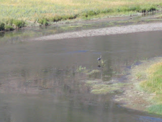
A Blue Heron in the Middle of the Madison


The original plan was to take two rest days in Grant Village. But the guidebook that I had didn't think that Grant Village was that nice. So, I didn't actually "rest", I changed my route and went to Norris Junction and Canyon instead (see the next two days).

Here's Old Faithful. Right on time (or not).


This Rarely Erupting Geyser (not Old Faithful) really let loose. So much so, it soaked at least 30 people who were walking along on the boardwalk near the geyser.


Back to this day. There was alot to see. The ride to Old Faithful is nice. It is a mostly flat ride along the Firehole River. Yellowstone actually allows off-road riding, so I rode from Fountain Flat Drive to Grand Prismatic Spring.


Not Quite the Grand Prismatic, but Nice Anyway.


Geysers, Geysers, Everywhere.


Many Pools are Blue. Very Blue.


This Geyser Isn't So Active. Just Blue.


Some Have Bacteria Growing in Them.


Leading away from Old Faithful and leading to Upper Geyser Basin was this bicycle-allowed path. I didn't know that you could ride single track in the National Parks!


Day 18 - West Yellowstone to Old Faithful to Madison Junction - 53 Miles